My guess is the Baldocci vineyard is the Feeney vineyard closest to River Rd, the one labeled on the 2007 SCGGA map as Tom Feeney Ranch. I say that because I remember in a post a month or so ago (in this thread?) Brian T. saying he drove by it as it was being ripped out and that Ledson was associated with it.
1 Like
Is this the post you are talking about?
Link
So the old-vine source of another critically acclaimed Russian River Zinfandel has been uprooted? If so, that’s pretty disappointing, if not surprising.
I found out that Dewey Baldocchi, whose vine material was submitted by Mr Dempel as prospective Clone Zin 29, participated in the Wine Library Association of Sonoma County’s Oral History Series:
Internet Archive
“Dewey Baldocchi”
Interviewed by Joseph Vercelli’ with G.M. “Puch” Puchilowsky
March 1982, Transcription 1994
Sonoma County Wine Library
Interview in “stream” format: Link
Unfortunately, the interview is focused primarily on the business side of early- to mid-20th Century Sonoma County wine production and grape-growing, a common theme in many of these older interviews (due to Prohibition’s impact on growers and producers).
Yes, that’s the post.
Although…your post which prompted Brian’s response describes a Ledson “Amy’s” vineyard as being atop a knoll. That vineyard (Tom Feeney Ranch, NW of the intersection of River Rd and Bisordi Ln) is very flat as you can see from Google street view.
That same post of yours says Steve Ledson was talking about a Bacigalupi vineyard (also acquired by Tom Feeney). If you look at the 1998 SCGGA map on Piner Rd west of Fulton Rd you’ll see a very small Bacigalupi vineyard right on the north side of Piner Rd. It is also just west of (gravel) Bacigalupi Rd which runs north from Piner Rd. The vineyards north and east of this small block are all labeled as Feeney on the 1998 map This small vineyard surrounding 2925 Piner Rd still exists and is all head pruned as you can see in Google street view. More importantly the area where this house is located is arguably on or very near a knoll.
I suspect the original Bacigalupi vineyard there was once larger and the head pruned block is a remnant. If you use Google map’s 3D (or street view) to inspect the terrain there, you can see that the “peak” of the knoll is to the east and is now in the large (modern) vineyard area labeled Feeney in the 1998 map. Everyvine still shows the vineyards there as “Tom Feeney Ranch”, but the little head pruned block is unidentified. The Ledson winery website doesn’t show any Amy’s zin at this time as near as I can tell (btw the last vintage in CT for Ledson Amy’s zin was 2013). Bacigalupi Rd appears to be a driveway for 2889 Piner Rd according to Google street view, with prominent no trespassing signs at Piner Rd. Btw Montafi vineyard is just to the east of a block of (modern, trellised) vines on the east side of Bacigalupi Rd.
I’ve often wondered if that little head pruned block surrounding 2925 Piner Rd is OV and who gets the fruit. Perhaps that is Amy’s vineyard. If it’s not then I suspect Amy’s vineyard was to the east and on the actual top of the knoll (which is now all modern vines).
According to an older Ledson blog entry, the “Amy’s Vineyard” was next door to the “Montafi Vineyard”.
Steve Ledson: Living Life to the Fullest blog
“Old Vine Zinfandel”
October 2, 2012
“…The 2009 RRV ‘Century Vine’ Zinfandel Reserve comes from a vineyard right next door to ‘Amy’s Vineyard.’ It was planted by a friend of my father’s, Henry Montafi. Dad said the vines were planted around the turn of the century!”
1 Like
Here’s a google map satellite view of the area:
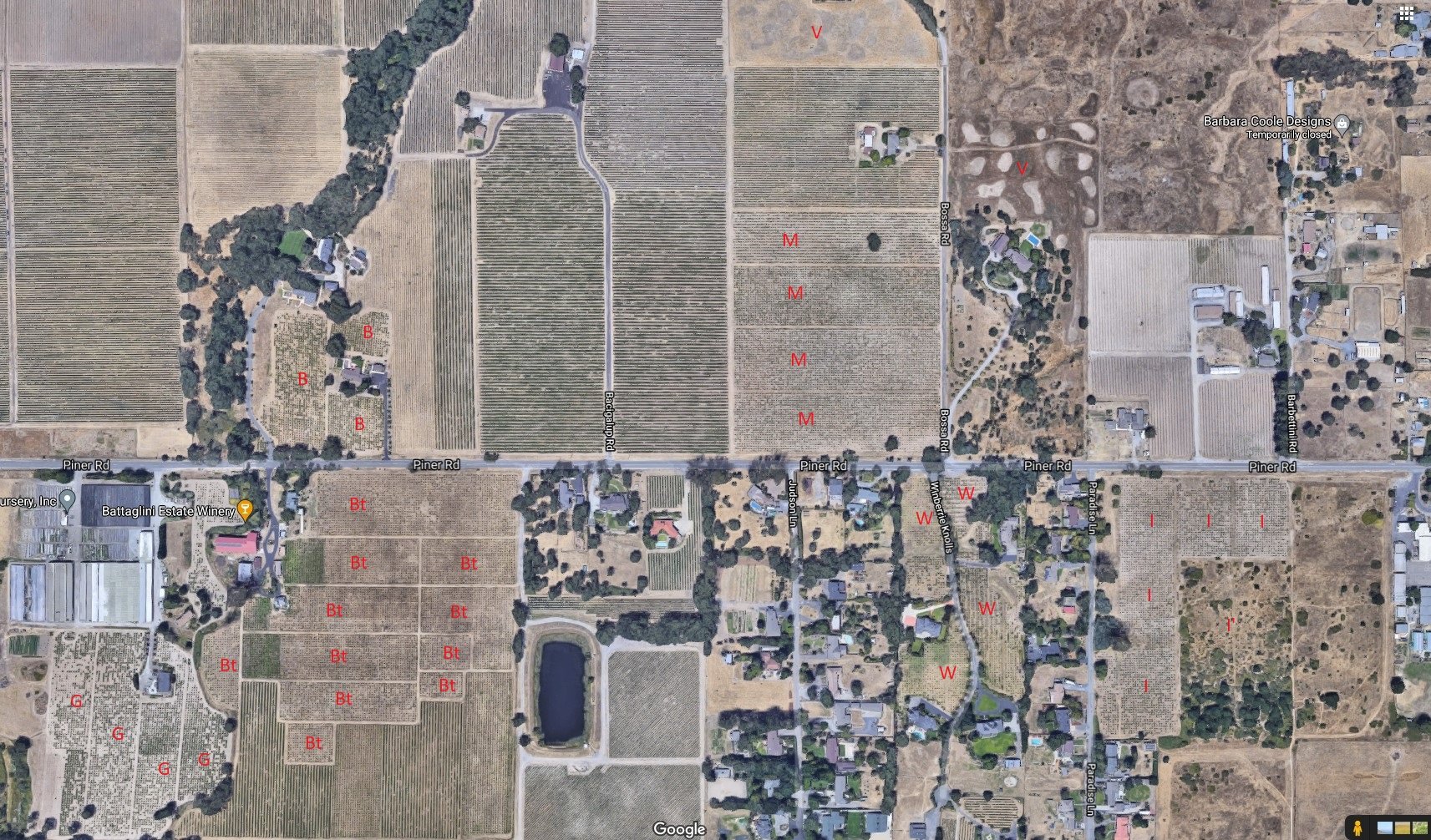
Old vine vineyards:
M: Montafi
V: ex Vera Gold
B: Bacigalupi
Bt: Battaglini
G: Gaddis
W: Winberrie
I: Imwalle
I’: long abandoned vineyard, but it clearly shows 8x8 spacing.
The Imwalle vineyard is labeled as such on the 1998 SCGGA map. It is supposedly owned by the city of SR (see the elementary school - now a charter school- just to the east). I was told that Harvest Moon winery gets the fruit, but I’m not sure about that. It is surprisingly large for an “unknown” OV vineyard. Google Street view shows it as clearly OV and the vineyard is definitely maintained. It was pretty clearly much bigger in the past.
The top of the “knoll” is just east of the northernmost block of the Bacigalupi vineyard.
1 Like
I’ve attached the oldest historical USGS 7.5’ topo that shows agricultural detail for the area, the Sebastopol quad from 1954. This is actually the 1959 edited version, but the 1955 edited version is essentially the same and is a little harder to make out the vineyard details.
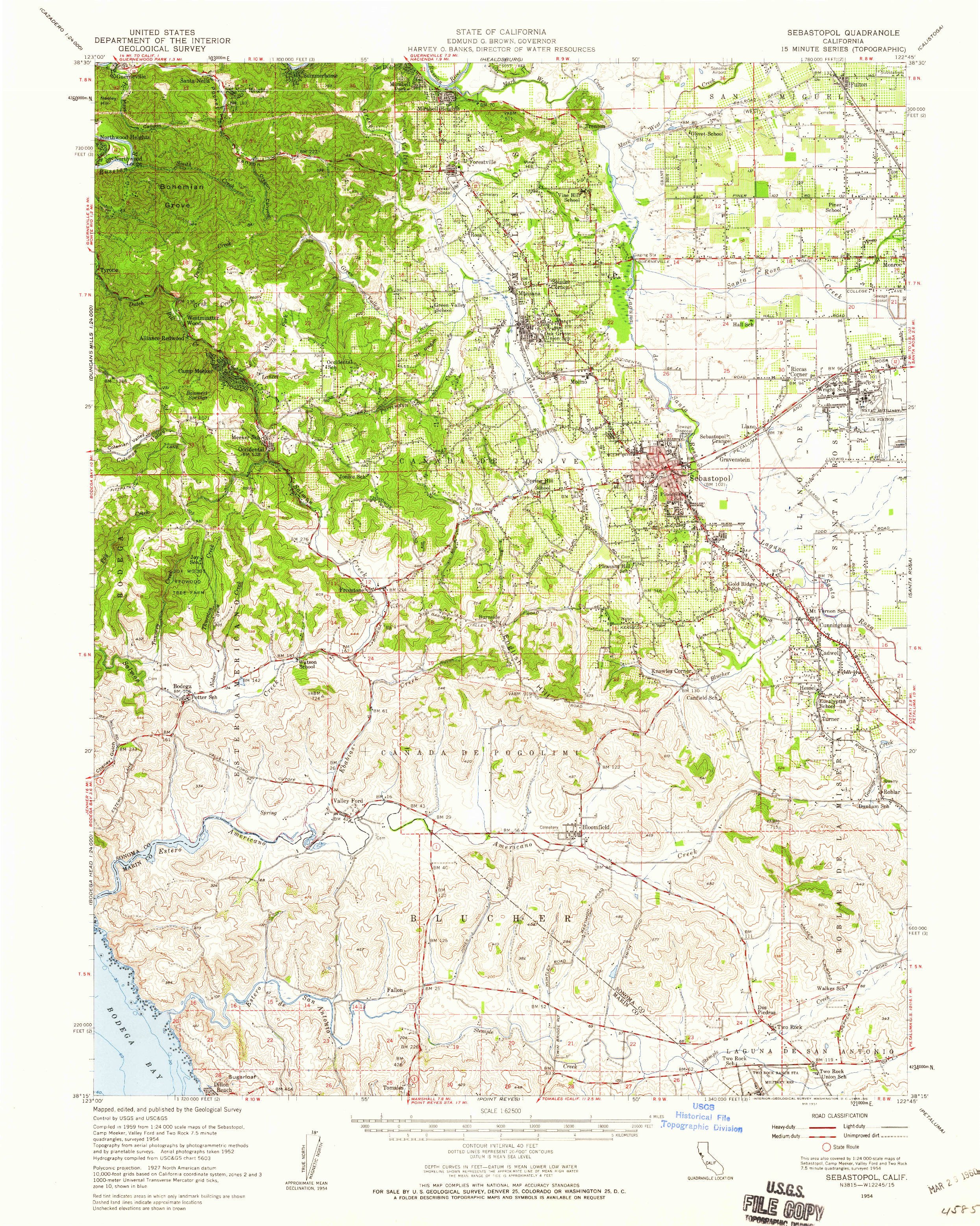
To orient yourself on the USGS map, zoom into the upper right hand corner and find the “Piner School” just west of (unlabeled) Fulton Rd near Fulton Rd’s intersection with Piner Rd. The Piner school on the USGS map is south of the modern elementary school on the Google satellite view I pasted above. It actually still exists as a church. You can see it on Google street view. In the USGS map you can see the original extent of the Imwalle vineyard as well as the rest of the vineyards in the area.
It’s also interesting to scroll up to the Wood Rd area north of Piner Rd. You can see that the Arata vineyard was indeed bigger back then.
Finally, it’s interesting to look at the 1942 aerial photography of the area compared to modern views via the Sonoma county “vegmap”:
http://sonomavegmap.org/blog/2014/08/16/1942-aerials-of-sonoma-county-laguna-de-santa-rosa-watershed/
The vegmap isn’t terribly useful though. For some reason vineyards don’t seem to show up very well, but orchards certainly do. This is apparent if you look at the Wood Rd area. The vineyards there show up as broad, white areas. Not sure why that would be. They’re definitely there. For example, you can see the individual blocks within the Papera vineyard.
2 Likes
Regarding the Imwalle vineyard, my friend was tasting at the Battaglini tasting room several years ago and inquired about that vineyard and Joe Battaglini told him that the vineyard was farmed and harvested by Harvest Moon winery https://harvestmoonwinery.com
A subsequent visit by my friend to Harvest Moon’s tasting room confirmed that. At some point (my friend doesn’t recall when), it was divulged that the city of Santa Rosa owns the vineyard. Neither place called it “Imwalle”, so that designation for it has apparently been forgotten (but it was clearly labeled that on the 1998 SCGGA map).
You are on a roll, Clyde!
The last name of a person living in a house on this 49-acre parcel is Imwalle. It is designated for “diverse agriculture”, while most of the neighboring vineyards are zoned for “intensive agriculture”. The ARCGIS map lists it as government property.
APN# 034-091-018-000
2688 Piner Rd, Santa RosaIt is odd that such a large plot of vines would remain, generally speaking, unrecognized by RRV Zinfandel wine producers. I haven’t tasted Harvest Moon’s Zins…yet.
Fascinating, but as near as I can tell there is no house on the parcel. The house on Piner Rd just to the west of the vineyard is 2768 Piner and all the houses to the west of the long North-South block of the vineyard are on Paradise Ln.
I’m guessing that in the 60’s when the “new” elementary school was built the city bought the entire parcel, including the vineyard. If there was a house it would’ve probably been just west of the elementary school on Piner. The city must’ve been leasing it all this time.
Thread Drift alert! I received the following email from Dutton-Goldfield:
"Vines from the turn of the LAST century:
Morelli Lane Vineyard Zinfandel
"Ah, if these vines could only talk, the stories they would tell. Perched on top of Stoetz Ridge in western Green Valley, the Morelli Lane vineyard now plays home to less than 2 acres of what was once a larger planting of Zinfandel. When the Duttons leased the property back in the mid-1990s, the vineyard was in sad shape, overgrown and run down, with the fruit enjoyed by the local deer population. They pushed out much of the vines for more economically viable Chardonnay and Pinot Noir, but saved the best part at the top of the ridge and began the rejuvenating project, getting the old gnarled Zin back into production.
“When they leased the vineyard, they were curious how old the vines were, so they asked the current tenant of the home on site, and the last remaining family member, Vic Morelli. He replied that he used to prune the vines when he was a kid, and they were already old then. He was 95 at the time, meaning the vineyard must have been planted in the late 1800s. The vines have managed to survive through a century of changes, including prohibition. Amazingly, they continue to produce fruit from the 1.8 acres remaining, which we are honored to craft into a very special, cool climate, Pinot-winemaker’s elegant Zinfandel…”.
I enjoyed the 2004 and '05 Zinfandels from Dutton-Goldfield years ago. They reminded me of the Hartford RRV Zin, though slightly more nuanced, less firm, with not as noticeable oak influence.
Dutton-Goldfield website:
Here is how I came to believe that the person in question lived on the property:
· I accessed the map by searching for “sonoma county arcgis map”, then zooming in on Piner Rd. Link
· I then performed a parcel search on the Santa Rosa Assessor’s Office website. This returned a physical address that corresponded to the APN. Link
· Finally, I did a Google search for the address, which provided me with the last name mentioned above. Link
Upon reviewing the parcel in question on the ARCGIS map, it appears that you are correct. There is no residential structure on the plot of land that includes the vineyard.
Don’t trust everything you read on the internet! ![]()
Below is the Alcohol, Tobacco Tax and Trade Bureau (TTB) roster of wine producers and blenders for Sonoma County in California:
https://www.ttb.gov/images/pdfs/foia_xls/frl-wine-producers-and-blenders-ca-sonoma.htm**This tool can assist map nerds in determining the location of specific wineries, which producers are found in a certain town, etc. Vineyard owners are not included, unless they bottle estate wines, however.**
I have found that it is easiest to perform a “find in page” internet browser search to locate wineries of interest.
For example, I will select “find in page” from my Chrome menu (on the top-right corner of the browser) and type in “Healdsburg” or “Arnold Dr”.
1 Like
Excellent detective work Drew!
I think the vineyard at 2688 Piner Rd (called the Imwalle vineyard on the 1998 SCGGA map) probably did have a house on it many years ago, and the last person to live in it was Joe Imwalle, as your Google search of the address found.
Btw, the Imwalles have a long history as farmers in Santa Rosa. I suspect that that Joe Imwalle was/is related to them. Imwalle’s Gardens still exists at 685 W 3rd St in Santa Rosa. It is iterally a farm in the middle of the city. Here’s some history:
[url][https://sonomafb.org/imwalle-gardens-four-generations-and-120-years-of-selling-produce-to-santa-rosa-residents//url]
It doesn’t mention anything about a vineyard though.
A handy keyboard shortcut for “find in page” is Ctrl-F (control F). Press the Ctrl and F keys at the same time and it’ll bring up a search box that you can type into. The Esc (escape) key will clear it.
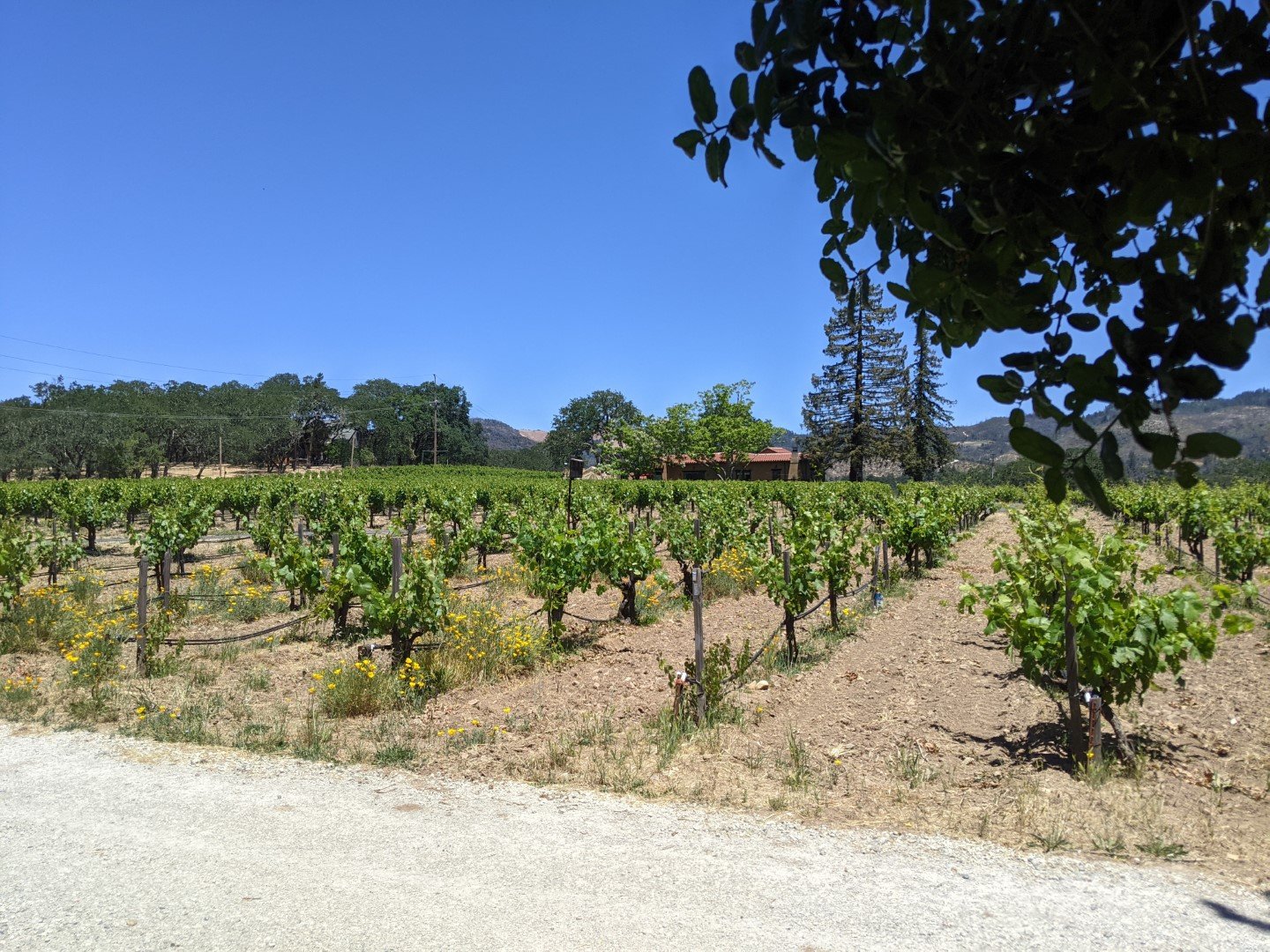
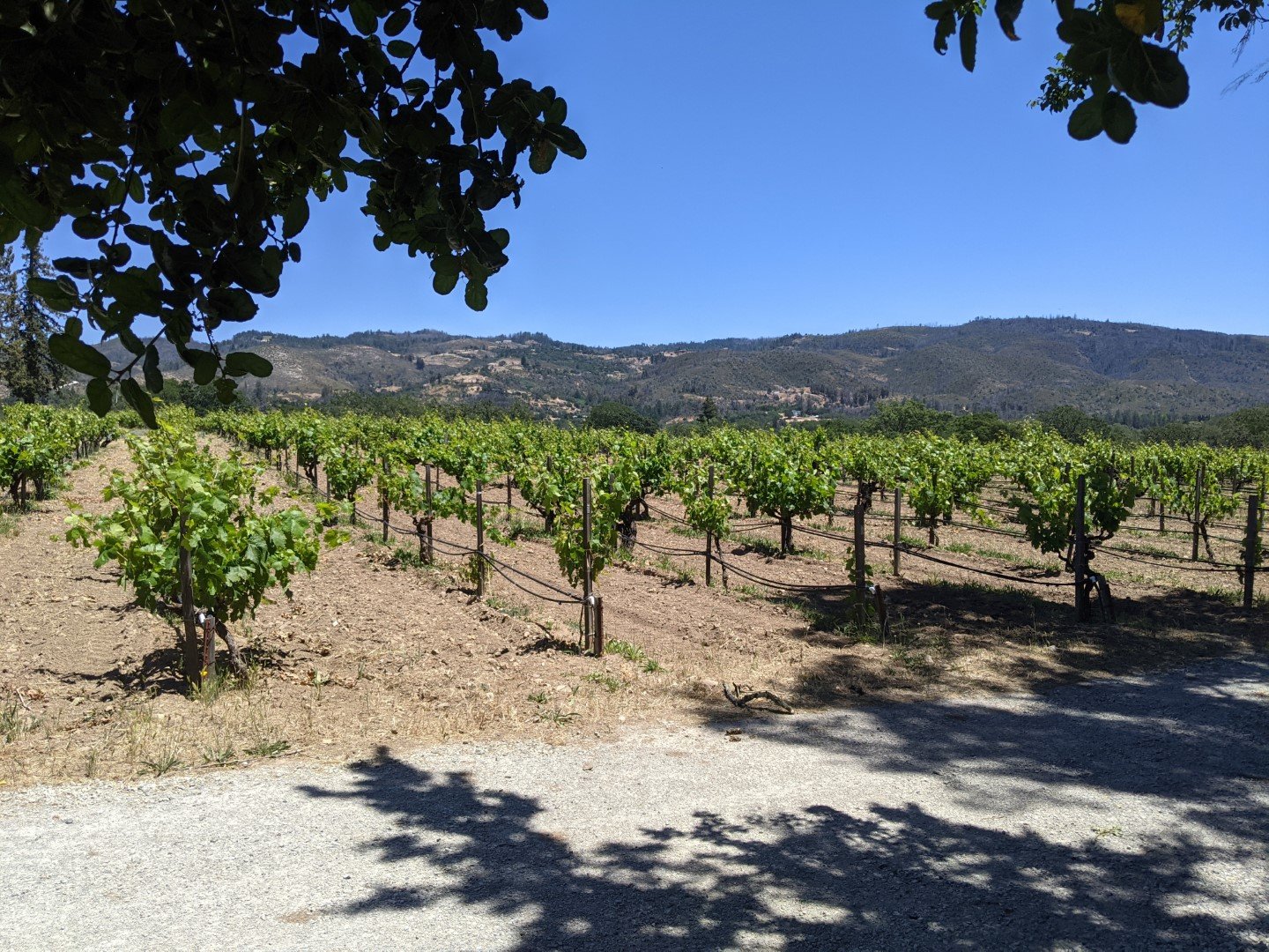
Last Tuesday I picked up a couple of bottles at Bucklin Old Hill Ranch. Will graciously let me take some pictures out in the vineyard.
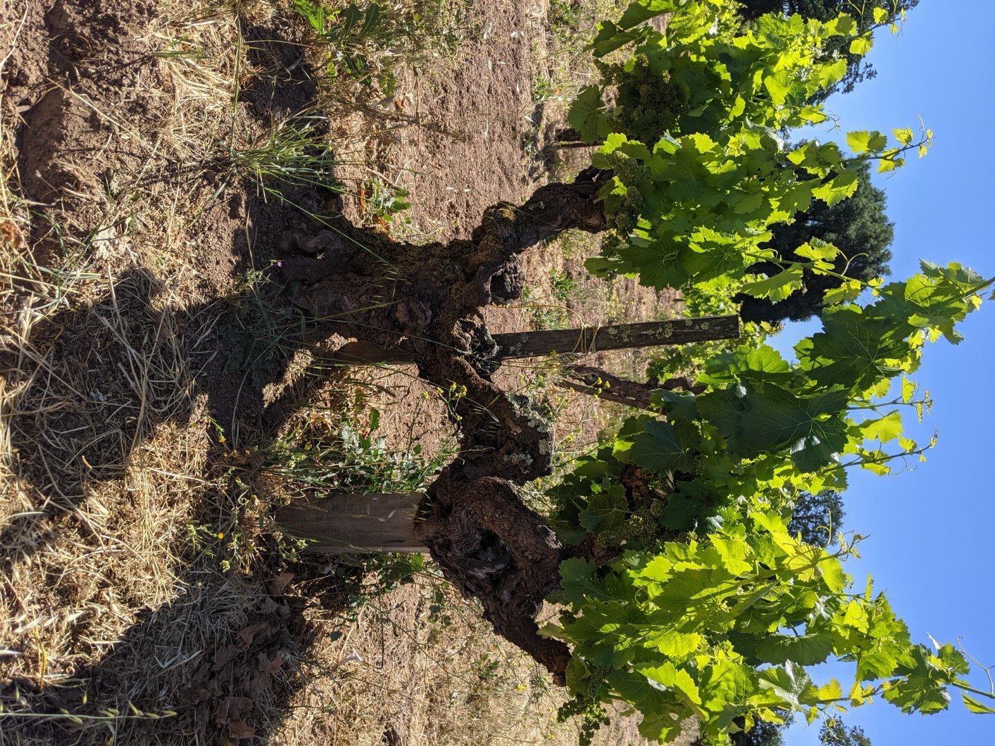
The Old Hill Ranch vineyard is just west of the BR Cohn winery on Hwy 12.
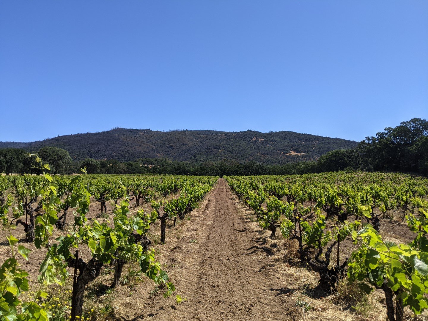
As long as I was in Glen Ellen I drove back on Dunbar road and over to Henno Road to take a couple shots of the old vine vineyard called the “Justi Creek Vineyards Heritage Block (Mancuso)” by the HVS. This ov field blend vineyard is a block within the vineyard labeled as the Morse vineyard in the SCGGA 1998 Sonoma Valley AVA map. It’s now owned by John Lasseter (Lasseter winery). Lasseter bought the old Carmenet vineyards and winery on Vintage Lane and bottles a $75 “L’AME DU SAGE” from the vineyard. We tasted it at the winery several years ago and it was very good. Phil Coturri farms the vineyards.
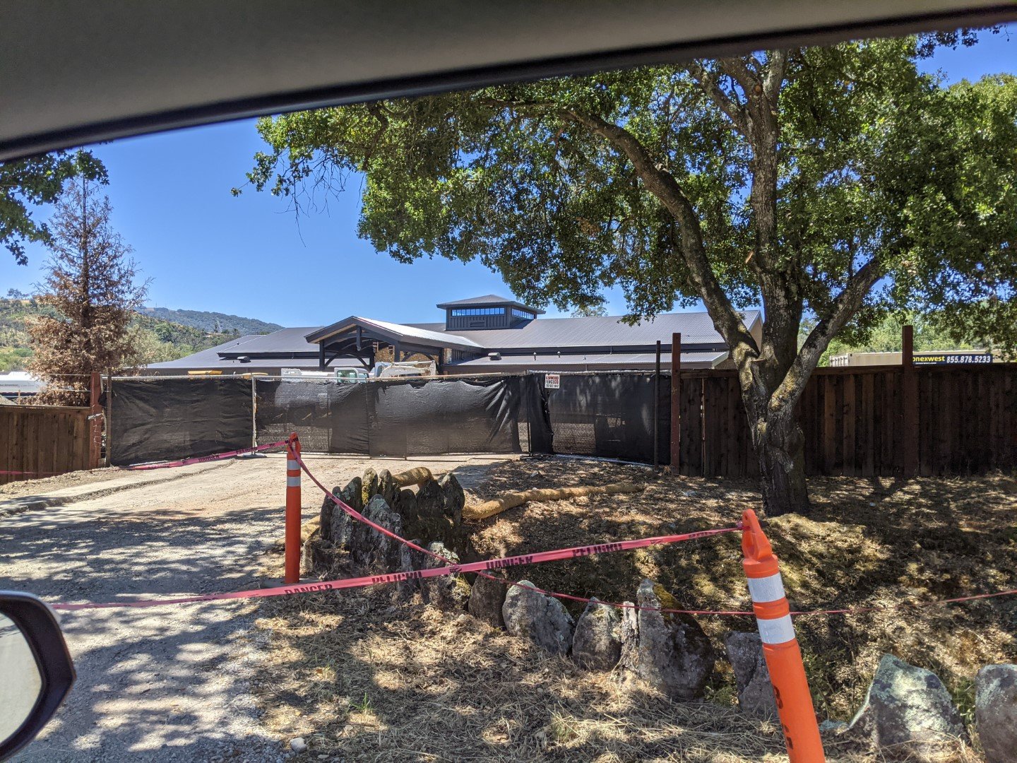
But as I was driving up Dunbar on the way to Henno Road I was shocked at a gigantic building being constructed out in what was formerly John Lasseter’s estate 1:1 scale train set. Lasseter has an extensive personal collection of vintage amusement park narrow gauge railroad equipment, much of which previously ran in Socal at Disneyland and other locations. The track “layout” (which is north of his residence on Dunbar) can be seen in Google maps. The new building is smack in the middle of his layout.
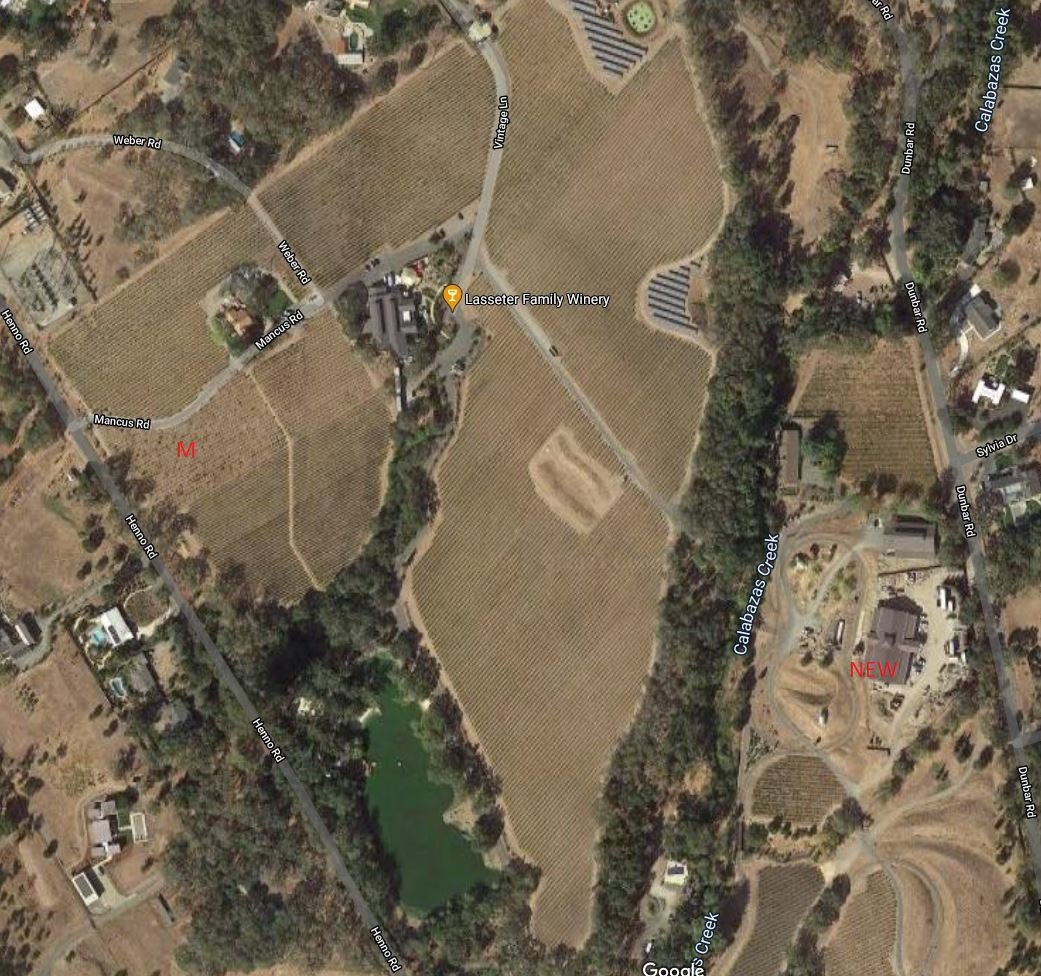
M = Morse/Mancuso vinyard (note the Mancus (private) road just to the north of the vineyard.
NEW = New Lasseter winery building.
Perhaps Lasseter has more time on his hands nowadays.
1 Like
Since you two are map/history geeks maybe you’ll enjoy this link. They did aerial mapping of Sonoma County during WWII as a snapshot if what was where in case the Japanese invaded or bombed. The current view is the left half of the screen and the 1942 version is the right half and you can scroll all over the SR Plain.
This was apple country and it’s evident.
1 Like
Thanks Brian. I pointed out the “vegmap” website to Drew further up in the thread.
One thing that’s weird about it though is the orchards are pretty obvious, but most of the vineyards show up as amorphous white areas. It’s very strange.
For example, here is NW from the intersection of Fulton Rd and Wood Rd:
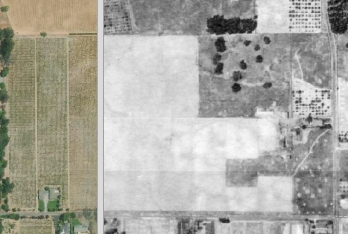
That’s Wood Rd at the bottom and Fulton Rd at the right. The vertical gray bar is the demarcation between 1942 and modern mapping. So that shows the Chelli and Arata vinyards (with the Arata vineyard apparently much larger than it is now).
It does have some interesting uses though. If you look at the Papera vineyard (NW of the intersection of Piner and Olivet), you can see that the portion of the vineyard with the more modern house on it appears to be an orchard in 1942. This is the house that’s to the west of the original ranch house. The original ranch house fronts Olivet Rd.
You can also see how gigantic the vineyards were surrounding the Carlisle and Gambogi vineyards on Willowside Rd. These are only small remnants of what was once there. Carlisle’s Two Acres vineyard was also huge then.
1 Like
Anyone else receive the offer today from Ridge? Their first vintage of San Lorenzo, from the Seghesio Family.
Keep in mind Clyde that Italians throughout Sonoma County often practiced coltura promiscua. Hence, those orchard areas could also be vineyard.
1 Like